Tongariro Alpine Crossing Track
|
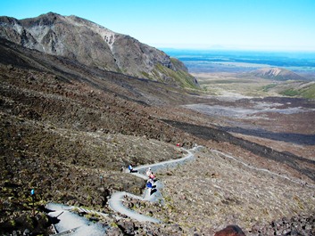
The Tongariro Alpine Crossing takes you over the length of Mt Tongariro (19.4 Kilometres) about 7-9 hours. You start from the Mangatepopo Valley (carved out from the last ice age) and walk over towards the Ketetahi road as this minimises the climbing involved, you will be glad you took this options when you come down from Red Crater. Mangatepopo Car park to Soda SpringsTime: 1-1/2 hours | Grade: easyYou start from the Mangatepopo Car park and walk to Soda Springs. This section is fairly flat with just an occasional short steep bit. The track is well formed and has board walk ways in the damper parts, with poles marking the way. Fifteen minutes from the car park the track to Whakapapa branches off to the right (3 hours). Just beyond this junction a 5 minute side track leads left to Mangatepopo Hut and a toilet. The main track continues up the valley following the Mangatepopo stream around the edge of old lava flows. |
Soda Spring to South Crater
|
South Crater to Red Crater
|
Red Crater to Blue Lake
|
Blue Lake to Ketetahi Hut
|
Ketetahi Hut to Ketetahi Car park
|
Summit TripsMt Ngauruhoe:Th A poled route leads from the edge of South Crater over to the base of Ngauruhoe. From here it is a matter of picking your own rout up; the best option is to follow the ridge of red scoria to the left of the scree slopes. The summit area can be dangerous and should be avoided if there are any signs of volcanic activity. The descent can be made relatively quickly but it is easy to lose control on the free-flowing scree and care is required. Allow 11/2 hours up from the saddle and 30 minutes down. If you want to climb Ngauruhoe and complete the Crossing in one day – ensure you allow plenty of time as it is a strenuous side trip. Mt Tongariro:The poled route to the summit of Tongariro branches off the Crossing just before Red Crater. It follows an undulating ridge that can be cold and exposed in poor conditions. However, in good weather if you have spare time, it can be an enjoyable diversion. Allow 11/2 -2 hours return. |
 Time: 40 minutes – 1 hour | Grade: Moderate – Difficult
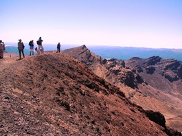 Time: 1 hour | Grade: Moderate – Difficult
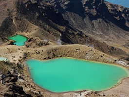 Time: 30 minutes | Grade: Moderate
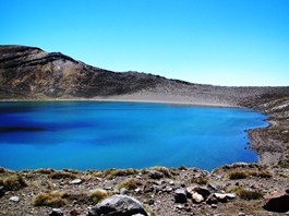 Time: 1 hour | Grade: Moderate
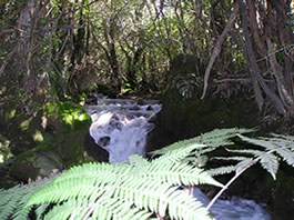 Time: 2 hours | Grade: Moderate
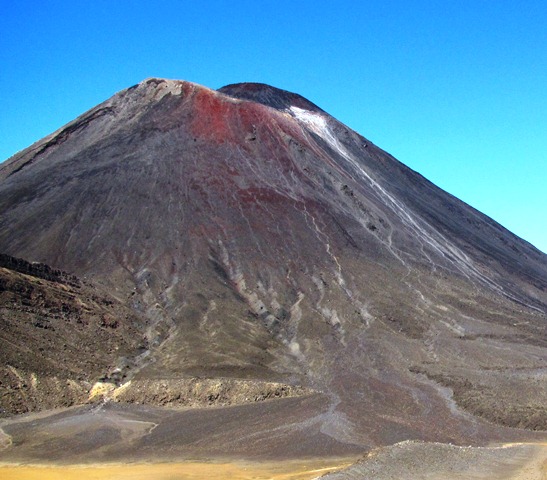 e route should only be attempted in summer unless you are experienced on snow and part of a well-equipped group.